CUIABÁ
Capital of Mato Grosso
.
.
All Brazilian capitals:
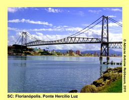
Aracaju (SE), Belém (PA), Belo Horizonte (MG), Boa Vista (RR), Brasília (DF), Campo Grande (MS), Cuiabá (MT), Curitiba (PR), Florianópolis (SC), Fortaleza (CE), Goiânia (GO), João Pessoa (PB), Macapá (AP), Maceió (AL), Manaus (AM), Natal (RN), Palmas (TO), Porto Alegre (RS), Porto Velho (RO), Recife (PE), Rio Branco (AC), Rio de Janeiro (RJ), Salvador (BA), São Luís (MA), São Paulo (SP), Teresina (PI), Vitória (ES)
Cuiabá was founded by bandeirantes (Brazilian pioneers and man hunters) when they discovered gold mines. The discovery attracted many migrants to Cuiabá in the eighteenth century. The historic center of Cuiabá still holds a number of monuments of that short golden era. Cuiabá is located at the geodesic center of Southern America and is considered as a strategic location where the landscapes of the Amazon Forest, the Cerrado Savanna, and the Pantanal Wetlands meet. Therefore, tourism is booming in the ‘Green City’ and in neighboring cities as Vila Bela da Santíssima Trindade, Cáceres, Poconé, and Barra dos Garças. Cuiabá is one of the host cities during the FIFA World Cup in 2014.


Cuiabá
Cuiabá is the capital of the state of Mato Grosso, one of the states of the Central-Western Region in Brazil. The state shares borders with the states of Amazonas, Pará, Tocantins, Goiás, Mato Grosso do Sul, and Rondônia, and neighboring country Bolivia. The municipality of Cuibá counts 3538 square km, of which 127 square km is urbanized. The average altitude is 125 m. According to numbers of IBGE (2011), the city hosts 556 thousand inhabitants. The Human Development Index is ‘elevated’, at 0.821 (2000).

History
According to the Treaty of Tordesilhas, the territory of Mato Grosso belonged to Spain. Jesuit priests arrived there to set up small settlements, but they were ousted by bandeirantes (pioneers and manhunters) from São Paulo, in 1680. The bandeirantes were hunting for indians, forcing them to work as slaves on the plantations. One expedition of bandeirantes was hunting for indians, when gold was discovered at the margins of the Coxipó River, one of the side rivers of the Cuiabá River. The bandeirantes changed their goal and constructed their first settlement, between 1673 and 1682. The settlement, founded by Manoel de Campos Bicudo, was named São Gonçalo. These bandeirantes did not stay there, and when another bandeirante, Pascoal Moreira Cabral, arrived there in 1718, the settlement was abandoned. His expedition had lost a battle against the coxiponé indians, but was lucky to find gold there. He became a gold seeker. On April 8, 1719, Pascoal, elected as regional commander-in-chief, signed a document that marked the foundation of the settlement, that was called (Arraial da) Forquilha (Fork). The document assured the rights of the gold discovery to the Capitania of São Paulo.

In 1722, more and richer gold mines were discovered. One year later, a church, with the name Igreja Matriz do Senhor Bom Jesus de Cuiabá was constructed. The news of the discovery of gold attracted many migrants to the region. In 1726, a regiment commanded by Rodrigo César de Menezes arrived at Forquilha. They were the representatives of the Kingdom of Portugal. On January 1, 1727, the settlement was elevated to a village, and was renamed into Vila Real do Senhor Jesus de Cuiabá.
Soon it was discovered that the gold mines were not that rich, and the city was abandoned by a large part of the population. However, on September 17, 1818, Cuiabá was elevated to the status of a city, and became the new capital of the province of Mato Grosso, on August 28, 1835, thereby replacing the city of Vila Bela da Santíssima Trindade.
There is no clear agreement about the origin of the name Cuiabá. One version states that it is derived from the Bororo word ‘Ikuiapá’ that has the meaning of ‘location of Ikuia’ (ikuia is an arrow, made of wild cane; pá is location). Freely translated as the ‘location where indians were hunting and fishing’.
Another possible explanation is the agglutination of Kyyaverá. That is a Guarani word for “River of the Shining Otter’.
A third explanation is that the word refers to existence of trees that produce cuia (gourd), at the margin of the river, and that Cuiabá might have the meaning of ‘the river that creates containers (made of dried gourd)’.

Colorful Historical Center
During the Paraguayan War (1864-1870), Paraguayan troops invaded the state of Mato Grosso, but never invaded Cuiabá. However, the population suffered a epidemic of smallpox, brought from Brazilian soldiers who fought the Paraguayans. Almost fifty percent of the population of 12 thousand died because of the disease. Following the War, Cuiabá was able to grow again. The main products were cane sugar and mining extractions. This prosperity did not last long, and the city impoverished again, until 1930, when infrastructural projected linked Cuiabá with the rest of Brazil: highways to Goiás and São Paulo, and airline services.
The expansion of Cuiabá accelerated with the transfer of the capital to Brasília in 1960, and federal migration programs, that stimulated Brazilians to live in the less populated regions. Only during the seventies and eighties of the past century, the city became more industrialized and modernized. More recently, tourism is another significant source of economic activity.

Agricultural activities in Mato Grosso
Economic activity
The economic activity in Cuiabá is mostly based upon (agro) industrial and commercial activities. Since Cuiabá is strategically located near three major ecosystems (Amazon Forest, Pantanal Wetlands, and Cerrado Savanna), and is considered as the geodesic center of Southern America, tourism is booming. It is expected that touristic activities will expand more thanks to the status of Cuiabá as one of the host cities during the FIFA World Cup in 2014.

The Historic Center in the middle
What to see
More than 100 photographs of Cuiabá (SkyScraperCity)
The historical center of Cuiabá contains about 400 buildings that were built in the period between 1722 and 1900. The buildings represent the styles from the baroque to the neo-gothic era. One of the principal buildings in the center is the Palácio da Instrução. The building in neo-classical style was inaugurated in 1915, and originally hosted a college and a lyceum. At present, it houses the Secretariate of Culture, the Museum of Natural History and Anthropology, and the Public Library.

Palácio da Instrução (l) & Catedral Basílica (r)
In 1722, at the time of the discovery of gold, a church was constructed of wattle and daub. It was the start of the urbanization of the tiny settlement. This church was dedicated to Jesus, and called Igreja Matriz do Bom Jesus de Cuiabá. Seventeen years later, this church was rebuilt, now of rammed earth. The first tower was constructed in 1769, the second in 1929, when the facade was renovated. In 1968, the church was demolished, to create space for a new church, made of reinforced concrete. The new Catedral Basílica was inaugurated in 1973.

The former Cathedral, before 1968.
Casa de Dom Aquino (1842) is now a Pre-Historical Museum. In this colonial-style house, two important persons were born: politician Joaquim Murtinho (b. 1848) and Dom Francisco de Aquino Correa (b. 1885). Dom Aquino was bishop, archbishop, governor, writer, and poet. The oldest church of Mato Grosso is the Igreja de Nossa Senhora da Penha de França (1721). It is located at the margin of the Coxipó-Mirim River and still exists, but needs to be renovated.

The oldest church of Mato Grosso
Another historical church is the Igreja de Nossa Senhora do Bom Despacho. The original construction dated back from the 18th century. Reconstruction in the neo-gothic style, took place in 1918, at the time of Dom Aquino. Igreja de Nossa Senhora do Rosário e São Benedito was constructed in 1730, in a typical colonial style. The facade appears very modest and simple, but the interior forms a sharp contrast with elements of baroque and rococo styles. The church had undergone various reforms, but is restored in the original colonial style.

Inside the NS do Rosário e S. Benedito
According to Marechal Rondon in 1909, Cuiabá is located on the geodesic point of Southern America. The marshal had traveled an impressive distance of about half a million kilometers in order to create detailed maps of Mato Grosso and neighboring states. He also was responsible for the construction and connection of the telegraph lines from Cuiabá with the rest of Brazil.

Memorial of the Geodesic Point
In 1818, the construction of Arsenal de Guerra (1832) was ordered by king Dom João VI, in order to have the ability to manufacture and store weapons. The neoclassical building now houses the SESC Cultural Center. Cuiabá is known for its calçadões, promenades in the center, flanked by many small stores, bars and restaurants. A number of calçadões recently have been renovated. Tourists may be interested to visit the Casa de Artesão that now hosts The Museum for Artesanato (Handicraft).
Cuiabá also hosts a number of urban parks. Parque Mãe Bonifácia is the most popular. The 77 hectare park once was a military training spot. Now it contains various pathways of in total 15 km, through natural habitats where wild animals may be observed. The 17 hectare Horto Florestal Toti Garcia is a kind of botanical garden with a collection of species of the ‘cerrado’. Morro da Luz (10 hectare) is another park in the center of Cuiabá. At 35 km from Cuiabá, Morro de Santo Antônio has become some gathering point for pilgrims from various religions.

Click on the image for the complete gallery
Chapada dos Guimarães is a National Park at 64 km from Cuiabá. The park has a size of 33 thousand hectares, the vegetation is typical of that of the cerrado (savanna). The park contains a variety of caverns, waterfalls (best known is Véu da Viuva (Bridal Veil)), lakes, and trails.
Other locations outside Cuiabá:
Vila Bela de Santíssima Trindade, is located near the border with Bolivia, at 525 km from Cuiabá. The ruins of the Igreja Matriz may be visited. The small city hosts many people of African origin, what is demonstrated with the annual Festa do Congo. Close to this city is the state park of Serra de Ricardo Franco, famous for the Cascata dos Namorados, the Lover’s Waterfall.

Festa do Congo
Poconé is located at less than 100 km south of Cuiabá. Located between the Cuiabá and Paraguay Rivers, the city is considered as the gateway to the northern part of the Pantanal Wetlands. The city is famous for its Cavalhada Festival, a festival of Portuguese origin that refers to the Crusades and the Troy war.

Cavalhada in Poconé
Cáceres is located near the border with Bolivia, about 200 km southwest of Cuiabá. Also Cáceres is considered as a gateway to the Pantanal Wetlands.

Sunset in Pantanal
Barra dos Garças is located at about 500 km east of Cuiabá. The city is located at the margins of the Garças and Araguia Rivers. Between June and August, one may enjoy the paradisaical river beaches. Another touristic highlight is Serra do Roncador, which attracts many tourists from all over the world in their search of mystical locations. It is the location where the British colonel Percy Fawcett, who was searching for the mysterious city ‘Z’, disappeared under mysterious circumstances. It is believed by them that highly developed, underground cities must be located there, but still inaccessible.
Links:
MT é Lindo / MT is Beautiful (MT government promotion site)
Cuiabá
Cuiabá 290 years
Cuiabá at night
Pantanal
Chapada dos Guimarães
Poconé – MT
Pantanal – bird symphony
GLOBO Reporter – Pantanal (complete)
Cavalhada Poconé
Cáceres – MT
Vila Bela da Santíssima Trindade
Serra do Roncador (1/3)
Serra do Roncador (2/3)
Serra do Roncador (3/3)
By Adriano Antoine Robbesom
.
Related articles
- Travel in Brazil: Bus Travel Belo Horizonte – FORTALEZA (02). Beach Paradise Porto de Galinhas (PE) (insiderbrazil.wordpress.com)
- Travel in Brazil: Bus Travel Belo Horizonte – FORTALEZA (01). From Belo Horizonte to Salvador (insiderbrazil.wordpress.com)
- Heading for Brasil 2014: Stadiums under Construction (Update OCT 2011) (insiderbrazil.wordpress.com)
- Travel in Brazil: SALVADOR (15). The District of Barra, Salvador (BA) (insiderbrazil.wordpress.com)
- Imaging Brazil (15): Praça Mohamed, Belo Horizonte (MG) (insiderbrazil.wordpress.com)
- Travel in Brazil: ALAGOAS (01). Bus Travel Through Minas Gerais, Bahia, and Sergipe (insiderbrazil.wordpress.com)
- Imaging Brazil (13): Curious Monkeys in Mangabeiras Park, Belo Horizonte (MG) (insiderbrazil.wordpress.com)
- Imaging Brazil: (06) Capoeira in Belo Horizonte (MG) (insiderbrazil.wordpress.com)
.


")